
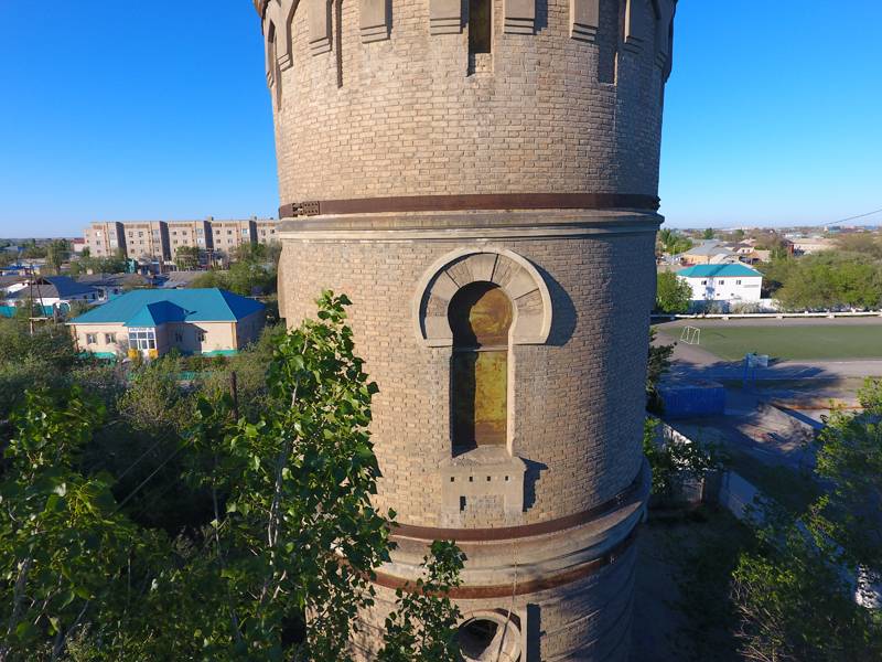


OBJECT INFORMATION
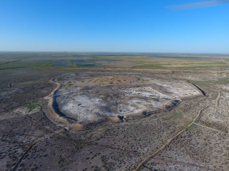
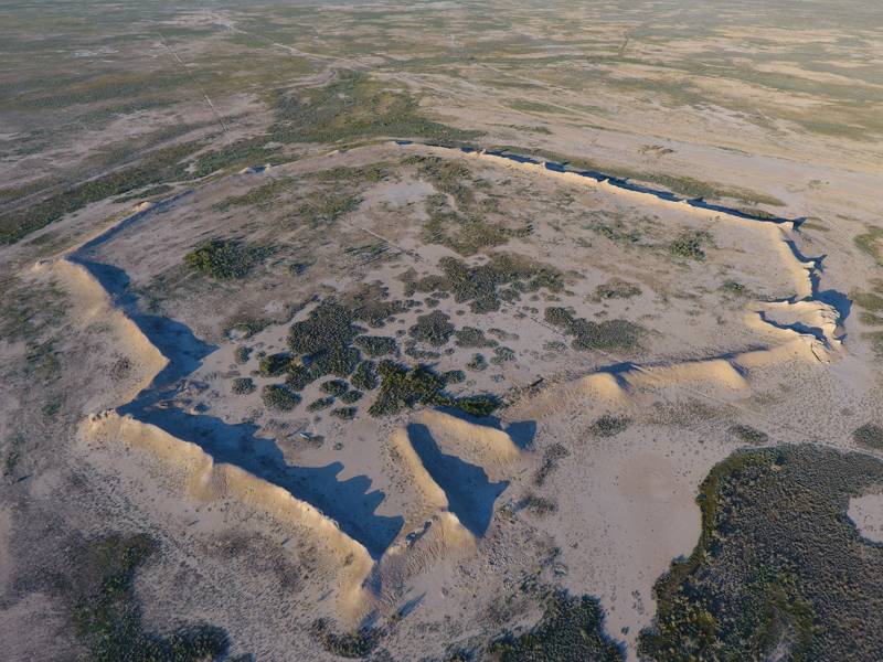
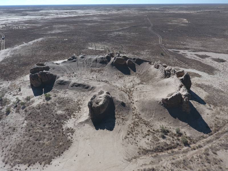
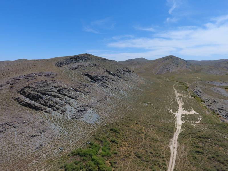
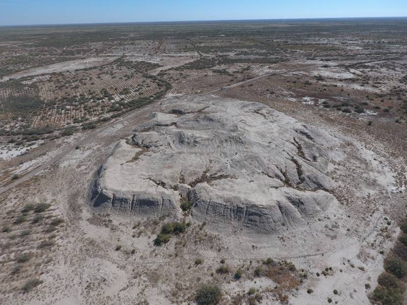
Sygnak site - VI - IX cc. The Sygnak site is situated 20 km north-west of the Tyumen-aryk railway station, 1.5 km to the right of the modern Turkestan-Kzyl-Orda route. The geographic coordinates are 42 T 336322 4892475
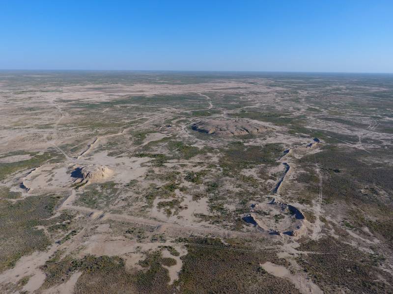
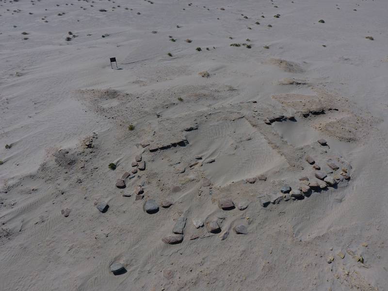
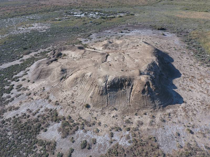
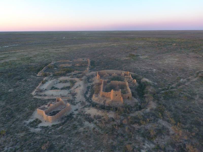
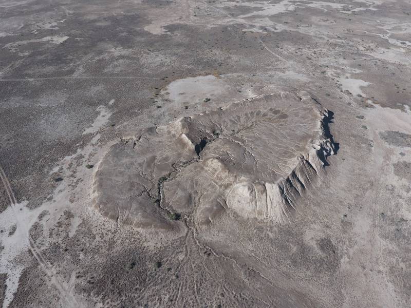
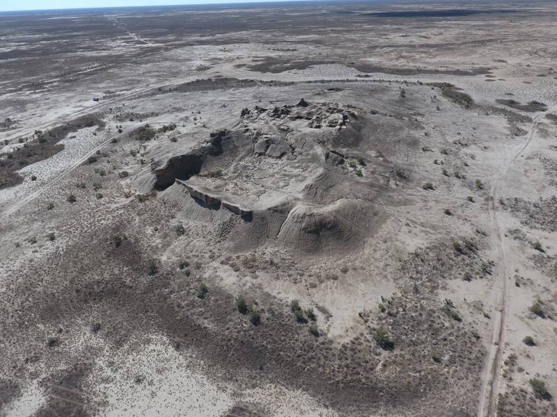
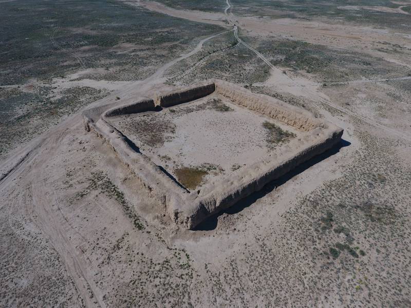
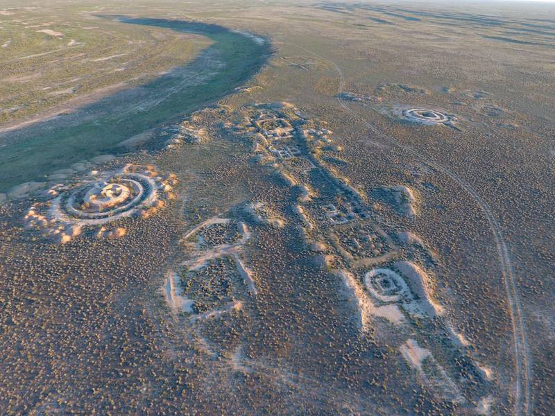
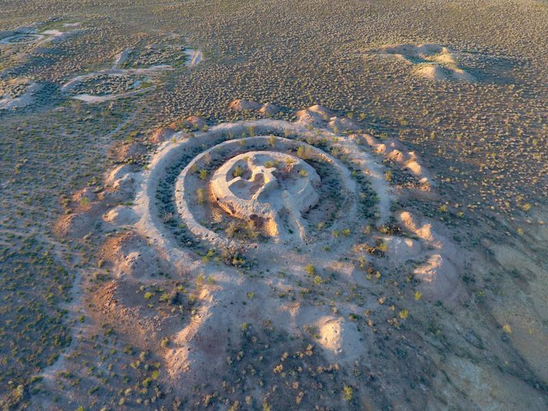
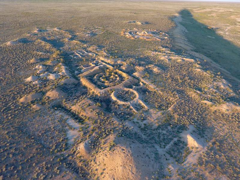
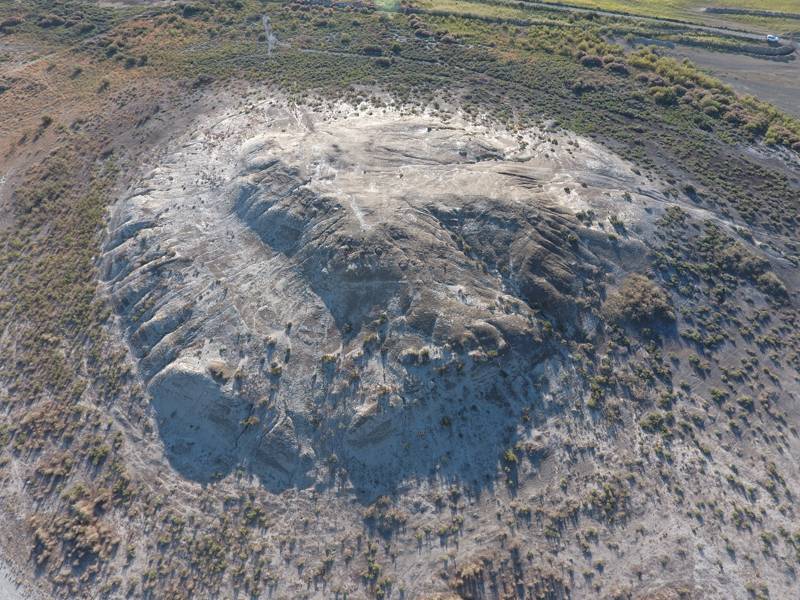
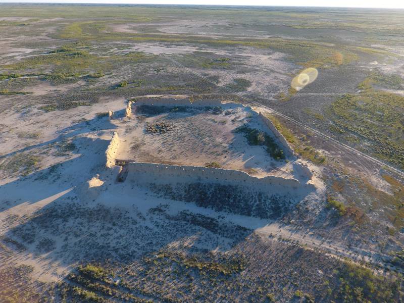
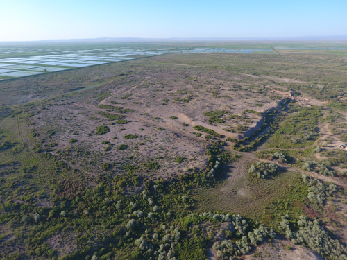
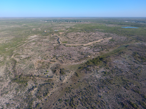
In 1867 P.I. Larch has turned attention to this. In 1907 they were investigated by A.Y. Yakubovsky, then in 1947 – South Kazakhstan Archaeological Expedition (A.N. Bernshtam), in the 70’s of XX century – paleo-ethnographic group of the South Kazakhstan archaeological expedition (S.Z. Zholdasbayev). In 2003 the archaeological expedition of the Department of Archeology and Ethnology of International Kazakh-Turkish University (S.Z. Zholdasbayev) performed a complex excavations. In 2004 the Turkestan archaeological expedition of International Kazakh-Turkish University (M. Eleuov) had distinguished its geographical coordinates. According to the plan, the hillfort has a pentagonal shape; it’s sizes are: in northern part – 275 m, North-West to West - 175 m, South-West to West – 190 m, in southern part – 175 m, South-East to East – 320 m. The entrance to the hillfort (in form of a 20 m long corridor) is situated in the south-east part of the monument. The height of defensive fortifications around the hillfort is 6-7 m in some places. There are remains of towers in corners of the monument as well as within 40-50 m from corners. According to the plan, Rabad and Shahristan are of a pentagonal shape. The sizes are: northern side – 250m, western – 360m, southern – 250m and south-eastern – 450m, eastern – 350m. The total area of a hillfort is about 20 hectare. The height of an earthwork, in which the wall has turned, draws to 6-7m. There are traces of buildings around the central ruins up to the 2 km such as granges, remains of irrigation fields, canals.
Historical evidences: The city of Sygnak was first mentioned in the sources of the 10th and the 11th centuries. It was named by Mahmud Kashgari Махмудом amongst oguz cities. In XII century Sygnak becomes a capital of kypchak national union and remains it until the beginning of the XIII century.
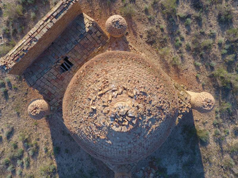
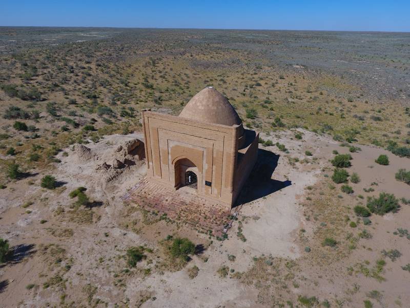
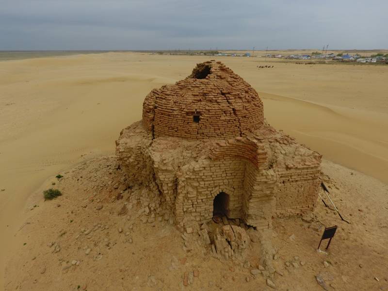
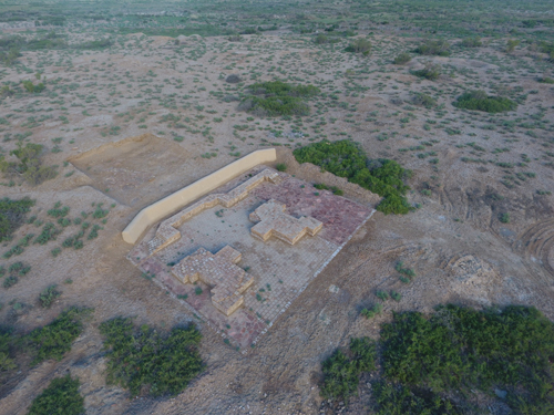
The 13th century historian Juvayni described the city’s destruction by the Mongols in 1220. Despite the destruction, the city was rebuilt, and in the middle of the XIII century Sygnak was mentioned in the routes of the Armenian king Getum. Gradually, the city turns into a major political and economic center on the Syr Darya. In XIII century Sygnak becomes the capital of Ak-Orda; mosques, bath-houses and other public buildings are being built in it. Being a part of a busy route of the Great Silk Road, the city flourished by trade and crafts up to the XVI century. Syngak, like the other cities located on the Syr Darya, in the XV-XVI centuries became the scene of a fierce struggle between the owners of the states of Central Asia and the Kazakh Khans. According to Ruzbihan, by the beginning of the 16th century, Sygnak experienced a downfall — a decrease in the number of inhabitants was observed, whereas in ancient times it “was flourishing, was surrounded by large buildings and fields, rich in various products and was a trading point for the Kazakh people. Merchants from the regions of Turkestan, Maverannakhr and from the East to the limits of Kashgar, Khotan bring the goods of these countries to Sygnak and carry out trade deals and exchanges with the people of Deshta. At this time, Sygnak was known for its architectural monuments and, before everything else, for the Kok-Keseni mausoleum. In the middle of the XIX century, the city was finally abandoned, like many other cities of Syrdarya.
 Main bibliography, archive materials, iconographic documents:
Ageeva E.I., Pacevich G.I. «From the history of sedentary settlements and cities of South Kazakhstan». Writings of the Institute of History, Archeology and Ethnography of Kazakh SSR т.V, Almaty, 1956; Akhinzhanov S.M. Kypchaks in the history of medieval Kazakhstan. – Almaty 1995; Baipakov K. M. Medieval cities of Kazakhstan on the Silk Road. Almaty, 2001.; Mahmud Kashgari. Түбі бір түрік тілі («Diwan Lughat al-Turk»). Translated by K.Beketaev, A. Ibatov Almaty 1993 – 16 p.; Pishchulina K.A. «Syr Darya cities and their significance in the history of the Kazakh Khanates in XV-XVII centuries. «Kazakhstan in XV-XVIII centuries» anthology.; Fazlallah ibn Ruzbihan Isfahani. Mikhman - name - yi Bukhara (notes of the Bukhara guest). Edited by A.K.Arendsa Moscow 1976 – 116 p.; S.Z. Zholdasbayev, M.M. Bahtybaev, S.S. Murgabayev Сығанақ жәдігерлері. Turkestan 2016 – 7-19 pp.
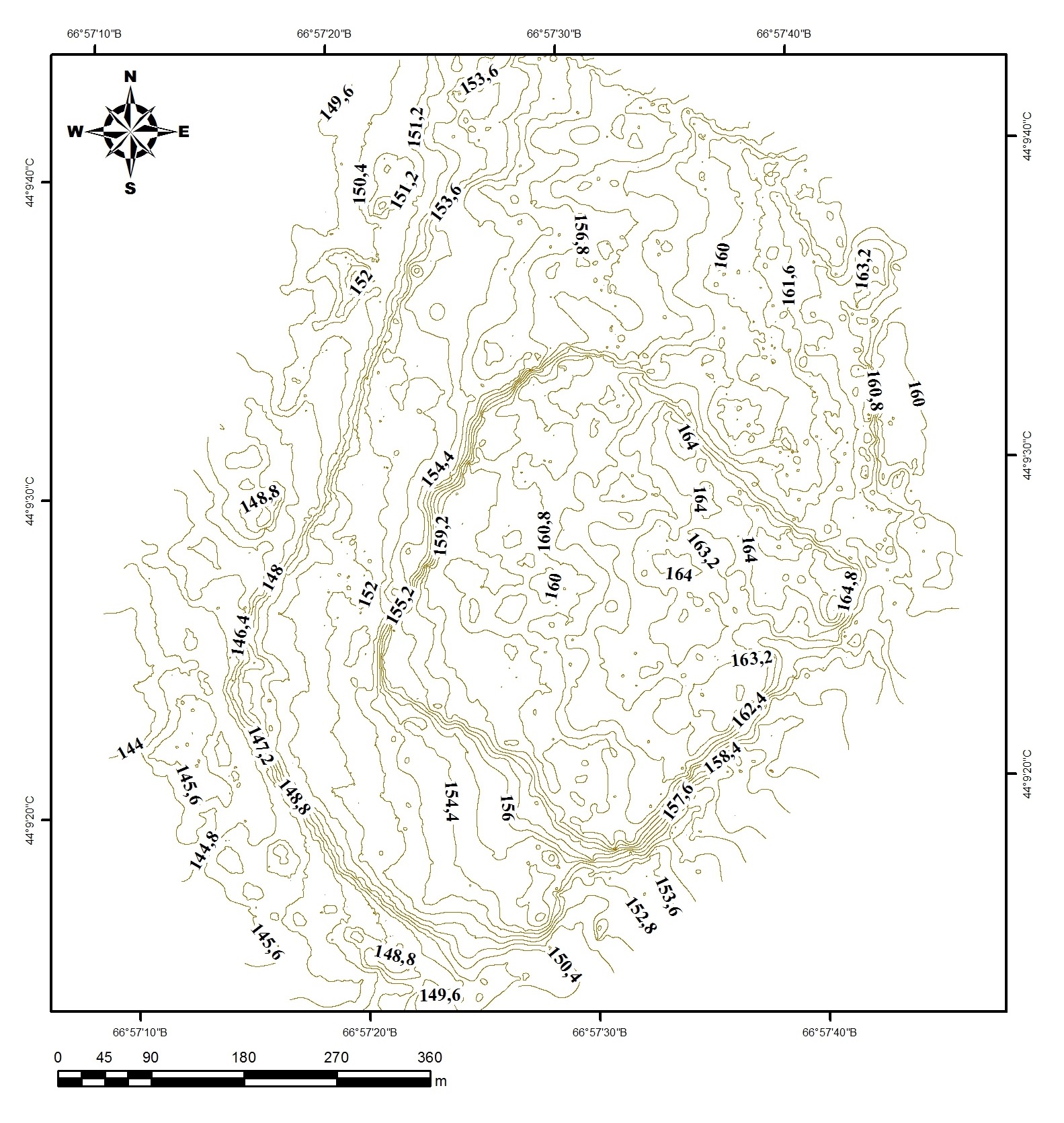
ТОПОГРАФИЧЕСКИЙ ПЛАН

 |
||
 |
 |
|
 |
||
|
||
|
|
|
|
||
|
||
|
|
|
|
||
|
||
|
|
|
|
||
|
||
|
|
|
|
||
|
||
|
|
|
|
||

|
||
|
|
|
|
||
|
||
|
|
|
|
||

|
||
|
|
|
|
||

|
||
|
|
|
|
||
|
||
|
|
|
|
||

|
||
|
|
|
|
||